A magical place that doesn’t go unnoticed by travelers. Reaching this remote village becomes a true adventure.
Iruya was founded in 1753. Located on the slope of a mountain, it is a town full of ups and downs, uneven streets, cobblestone paths, and buildings that remain frozen in time, transporting us back about 200 years.
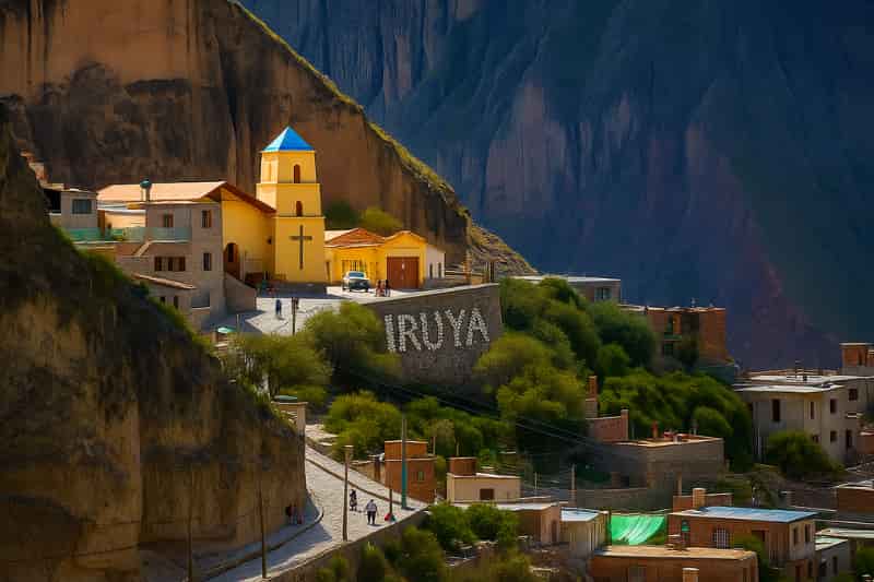
The church of Iruya is one of the most picturesque and oldest in the north—a must-visit upon arrival.
Tour to Iruya from Jujuy
| DEPARTURE PLACE AND TIME | 8:00 am – San Salvador de Jujuy 9:00 am – Purmamarca 9:30 am – Tilcara 10:00 am – Humahuaca |
||||
| RECOMMENDED CLOTHING | Comfortable sportswear, sneakers with grip soles, cap, sunglasses, a jacket, and sunscreen. What’s the weather like in the north? | ||||
| INCLUDED |
|
||||
| NOT INCLUDED |
|
Joined by the eastern Andes range, Salta and Jujuy offer us an exquisite landscape.
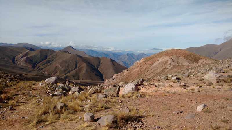
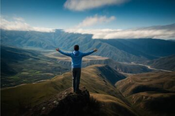
Crossing the Quebrada de Humahuaca and ascending the Santa Victoria mountain range forms a unique path that reaches nearly 4000 meters above sea level.
Driving along winding roads and crossing rivers are some of the challenges to reach this village carved into the mountain.
After traveling north along National Route 9, we leave the river and the Quebrada behind at the town of Iturbe, reaching Abra del Cóndor at 4000 meters above sea level.
The scenery offers diverse shapes and colors until we arrive at the village of Iruya at 2780 meters above sea level.
We explore the village’s uneven streets and stop for lunch.
In the afternoon, we reach the viewpoint known as “Mirador de la Cruz”, then descend and begin the return, wandering through the village’s alleys until reaching its iconic church.
On the way back, we visit the indigenous community of Hornaditas, where we meet the “Tata Churqui” and the “Cardón Abuelo”—two notable examples of native flora known for their size and longevity within the community.
History and features of Iruya
This area was primarily indigenous settlements, the most ancient being the Ocloyas.
They belonged to the Kolla ethnic group, descended from the Kollasuyo, one of the four regions of the ancient Tahuantinsuyo (Inca Empire).
Numerous ruins scattered throughout the area confirm the existence of a more or less homogeneous ethnic group before the arrival of the Spanish.
One example is the ruins of Titicónte, located 8 km east of Iruya.
The first inhabitants practiced agriculture and livestock farming—both on a very small scale, only for subsistence.
They grew corn, potatoes, oca, etc., and raised sheep, goats, and llamas.
As in ancient times, bartering is still one of the most traditional forms of trade in Iruya today.

Its name means “Place of high grasslands”. Iruya is surrounded by two rivers: Coranzulí and Milmahuasi.
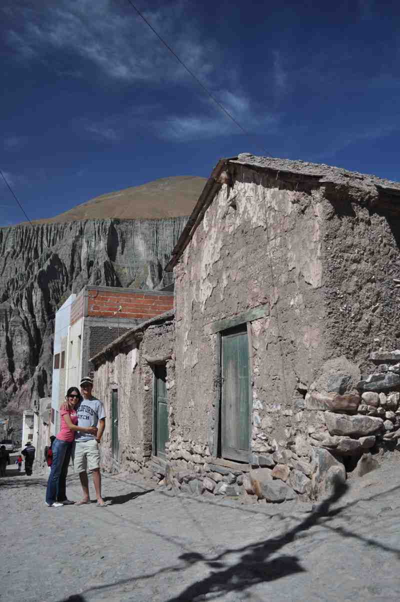
Iruya features colonial-style architecture, primarily made of adobe, stone, and straw.
Its streets are very narrow and steep, paved with stones to prevent water erosion.
Currently, due to a lack of urban planning, the village’s appearance is changing with large constructions that fail to respect basic urban standards.
One of the most striking aspects of this place is that its inhabitants still preserve clothing styles and traditions dating back over 250 years.
Although the town is accessible by vehicle, exploring the surrounding areas requires good physical condition for walking.
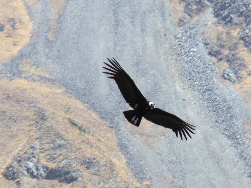
Ascending to Abra del Cóndor, the highest point

The journey begins with a winding climb through a true desert landscape until reaching 4000 meters above sea level at Abra del Cóndor.
This is the natural border between the provinces of Jujuy and Salta, offering breathtaking panoramic views.
From this point, there is a 1220-meter descent over just 19 km.
A road full of curves and cliffs, with absolutely stunning scenery.
After crossing the Milmahuasi River (the same one that can block access to the town during summer rains), you arrive in Iruya. The town appears in all its glory, nestled in the heart of the mountains.


Tour Reviews
There are no reviews yet.
Leave a Review
Show reviews in all languages (5)